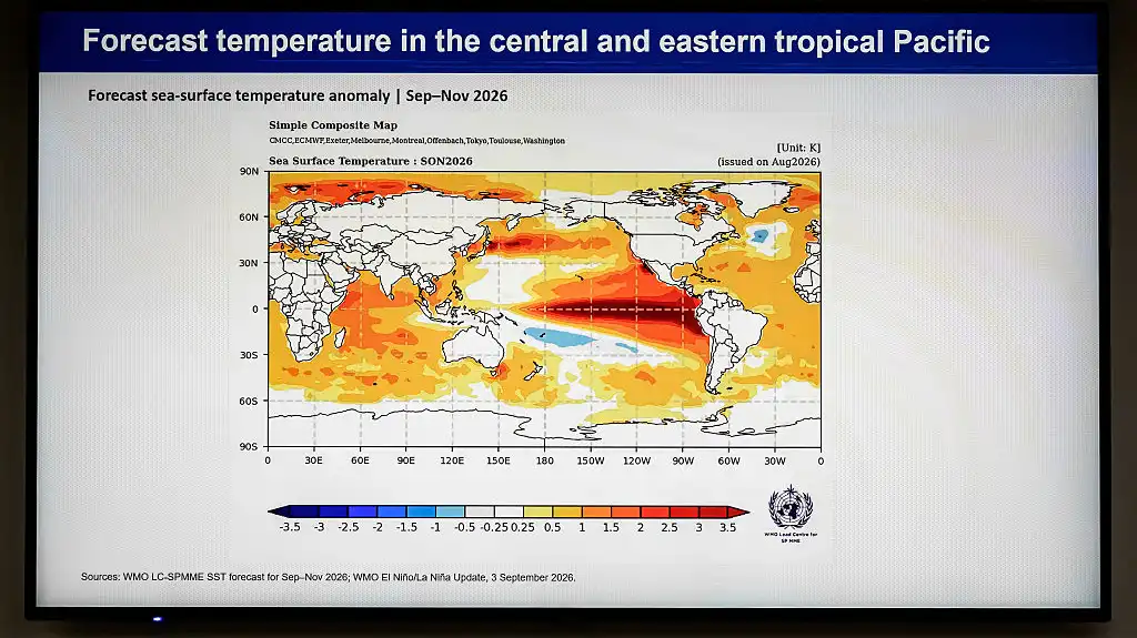
It’s looking like this year’s El Niño could be one for the history books. An El Niño is a climate pattern that occurs every two to seven years in which warm water in the Pacific Ocean affects wind currents, resulting in rainy conditions for some regions and extremely dry conditions in others. This one is poised to be especially strong according to the National Oceanic and Atmospheric Administration, which noted that high temperatures in the Pacific Ocean could lead to a “historic event that would exceed the strength of previous El Niño events.”
For catastrophe modelers like Dan Ward who forecast the cost of extreme weather damage, that’s already being factored in.
“During an El Niño, and a particularly strong El Nino like the one that is occurring right now, a lot of the activity shifts toward the Pacific,” said Ward, who is the senior director of modeling at Karen Clark and Company. “We've seen a lot more hurricanes and typhoons impacting places like Japan and China. And we've even had a couple hurricanes pass very close to the Hawaiian Islands, which is quite unusual.”
In 2022, Marketplace's Amy Scott was reporting on catastrophe modeling for Season 2 of "How We Survive." She and Ward watched Hurricane Ian make landfall from his office. Four years later, Scott called him up to hear how this year’s El Niño is affecting modeling, what it might mean for the insurance industry, and a lot more.
To listen, use the play button at the top of the page.




 8 hours ago25:26
 15 hours ago8:18
 21 hours ago13:11
 2 days ago30:58
 7 days ago28:46
 4 months ago24:33