Turning to drones and other instruments to hunt hurricanes
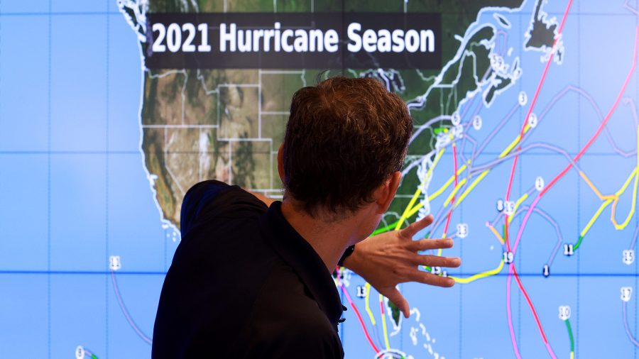
Forecasters from the National Oceanic and Atmospheric Administration, NOAA, predict yet another season of “above-normal” hurricane activity — the seventh year in a row.
To track and predict these storms, scientists rely on data from satellites, radar and planes.
This year, on top of that technology, staff at NOAA will also be using a fleet of autonomous vehicles in the air and at sea to reveal new data about what happens during the worst of a storm.
According to Jason Dunion, the NOAA’s hurricane field program director, it’s not just the sky we should be looking at when we’re studying these storms. The following is an edited transcript of his conversation with Kimberly Adams.
Jason Dunion: We talk about the atmosphere, it’s a really important part of what makes a hurricane tick, but so is the ocean. So we’re testing a lot of different platforms. We have buoys. We have an instrument called a Saildrone that’s very interesting and actually sailed right into a hurricane last year, collecting all sorts of observations where we don’t want to send ships, but we don’t mind sending a drone. We’re getting information about the waves and what the ocean temperatures look like. We even have hurricane gliders, so these are floating out in the ocean, and they do these dives from the surface down to several hundred meters, to give us an idea of well, we know what the the temperature of the ocean surface looks like? What does it look like down below? Because there’s more energy down there, that warm water can help feed the storm, so that’s really important information that we can gather as well.

Kimberly Adams: This year you’re also trying out something new to monitor hurricanes as they form — small, autonomous planes. How do those work?
Dunion: So they’re un-crewed aircraft systems. The advantage to these, they’re little winged planes that have about a 6- to 8-foot wingspan so they’re quite small, is that we actually can launch them from our P-3 hurricane hunters. So rather than launch them from hundreds or even several hundred miles away from the storm, we actually fly the plane to the storm, and then drop them right into the environment. And they can fly for an hour, two hours, even three hours, sampling parts of the storm that we don’t usually get to sample.
Adams: And do those drones come back, or do they just sort of get beat up by the storm and descend into the abyss?
Dunion: The drones that we’re testing now — this is kind of the experimental phase — we launched them, we get the data that we want, and they’ll eventually make it down to the ocean, and we won’t get them back. The long-term plan would be to have these drones that can actually be deployed from the planes and then make it back, say, to a base in Florida, or somewhere similar, so we can reuse them again. We’re not quite there yet. But I think that would be kind of a long-term vision of how we’d want to use these drones.

Adams: So where does all this data you collect from the instruments, where does all this data go?
Dunion: So a lot of the data is going out to the forecast centers, because we want the forecasters to have access to this data. At the same time, we want to get all this data out to the modeling centers so that they can ingest it and get a better representation of: what does the environment look like around the storm, or what does the inner core storm look like itself. The combination of the data that we’re sending out to the different centers really gives us the biggest bang for our buck, as far as the hurricane hunting that we’re doing.
Adams: And when you talk about these modeling centers, you’re talking about supercomputers that crunch all sorts of data to spit out storms and predictions in the short term, as well as long term, about the climate, as well.
Dunion: Yeah, that’s a great point. We have models that are looking at weather patterns all around the world. We also have hurricane models that just focus their model runs over the storm itself. So the data is not only really important for right now, but it’s important for the the two-day model forecast, the five-day, or even going out a few weeks.
Adams: You all have used some of these instruments before, what’s specifically different about how you’re using them this year?
Dunion: We really want to look at rapid intensification of hurricanes. These are the storms, they’re very rare — the 95th percentile of hurricanes — that rapidly intensify, 35 miles per hour in just one day. So they’re very difficult to forecast. And they also can pose a real hazard for folks along the coast as far as preparing for a storm that might turn from a category one to category three, just overnight. So if we can start to pull apart some of these ingredients that are really important for rapid intensification, that’s going to help us in the future.
Adams: The research is so exciting, and these tools are really interesting. But we’re talking about storms that cost tens of millions, if not billions of dollars in damage and can be such a risk to people’s lives. What impact do you think having this kind of tech is going to have on the people who live in these risky areas?
Dunion: Yeah, if I look at all this technology — and as a researcher, it’s exciting to make these advancements. But we always have to remember the reason we’re doing this is to improve the forecast. So if we can improve the forecast incrementally every year, all those improvements really lead to what we’re trying to do, is really save lives and protect property so that folks along the coast have the best possible forecast that they could have.
Related Links: More insight from Kimberly Adams
The Saildrone Explorer SD 1045 records a video during its venture into the midst of Hurricane Sam on Sept. 30, 2021 (Courtesy NOAA and Saildrone, Inc.)
Jason mentioned the Saildrone. NOAA has a video of a the instrument as it rides out the category-four Hurricane Sam last year.
While NOAA is working on improving hurricane predictions, FEMA, the Federal Emergency Management Agency, is working on making homes and buildings in the path of these storms more resilient. Last week, the agency announced an initiative to update building codes so structures can better survive hurricanes, floods, and other natural disasters.
And NOAA isn’t alone in deploying drones during natural disasters. AT&T is upgrading its drone service in disaster zones in order to bring 5G to areas where big storms knock out the phone networks. CNET reports that in company’s initial tests, the drones flew 300 feet in the air providing coverage for about a 10-mile area on the ground.
AT&T hopes to be able to roll the drones out in about a month if they need to. I guess it depends on the forecast.
Stories You Might Like


The future of this podcast starts with you.
Every day, the “Marketplace Tech” team demystifies the digital economy with stories that explore more than just Big Tech. We’re committed to covering topics that matter to you and the world around us, diving deep into how technology intersects with climate change, inequity, and disinformation.
As part of a nonprofit newsroom, we’re counting on listeners like you to keep this public service paywall-free and available to all.
Support “Marketplace Tech” in any amount today and become a partner in our mission.